
Finding a Durham Street by Address
The Durham street directory is strongest when it follows an address through separate systems. Tax Administration makes the parcel the first anchor. Its card can provide REID, PIN, the owner display, location and mailing fields, and recorded deed or plat references. Durham Maps places the parcel among boundaries and nearby lots. The Register of Deeds supplies the legal instrument. A library street section can later add a dated household or business listing. No single result proves every person at a street address.
- Search the Durham street in the tax portal and save the Street #, Street Name, REID, PIN, legal description, and deed or plat reference.
- Open Durham Maps to compare the parcel with its boundary, zoning, aerial, planning, and adjacent-parcel context.
- Use the deed reference at the Register of Deeds to review grantor, grantee, instrument type, recording date, and legal description.
- Use voter information only as registration context. A voter record is not a promise of current occupancy.
- For a past period, compare the address with a library street directory or cross-reference volume, then confirm it with another dated record.
Keep the original Durham address string. A later search may need the postal spelling, the assessor’s normalized form, a unit number, or a historic street name.
Durham Street Directory Search Fields
Durham Tax Administration’s Detailed Property Information has four search paths: Owner/Business Name, Street, REID, and PIN. The Street tab is the practical start for a whole road because its Street # and Street Name fields are optional and can return a group of parcels. Narrow the list with a number, a map location, or the owner display. A street result is parcel-oriented, so it is not a block census or a resident list.
| Portal path | Field | Required | Durham entry note |
|---|---|---|---|
| Owner/Business Name | Owner/Business Name | Yes | Last, first; partial last name; or business name |
| Street | Street # | No | Optional street number |
| Street | Street Name | No | Leave out the street type and direction |
| REID | REID | Yes | Use the parcel’s tax identifier |
| PIN | PIN | Yes | Ten digits, or thirteen for a condominium |
A parcel key survives formatting differences better than a street name. Once a Durham street result identifies a likely lot, retain the REID and PIN before moving to a deed, map, permit, or request route.
Durham Street Search Normalization
The tax portal’s Street Name tip is unusually important: omit street types such as Rd or Dr and directions such as W or West. That is a database search rule, not a replacement for the postal address. USPS expects a deliverable address format, including a unit when it applies. Older Durham directories may preserve a different spelling, while a recorded deed can use only a legal description. Search each known form and retain the date attached to it.
Street closings, renamings, extensions, and annexation can explain why a directory street search and a current map fail to line up. Durham’s proceedings cite G.S. 136-96 and Charter §51.2, and a renaming request requires a parcel map. When a historical Durham street has disappeared or changed form, look for the current parcel and relevant proceeding instead of assuming the older source is wrong.
Note: A normalized street query is a search aid, while the original spelling remains evidence for comparing historical and postal records.
Durham Parcel Details by Street
A Durham parcel card separates information that is often mistakenly merged. The sample card can show REID, PIN, property description, location address, owner name, owner mailing address, plat book and page, deed date and book/page, acreage, planning jurisdiction, permit number and date, sales history, improvements, and appraised or taxable values. A situs address means the property’s physical location. An owner mailing address is where tax mail is sent. Neither field alone identifies every current household member.
- Parcel
- A tax and mapping unit tied to Durham’s REID or PIN, not a record of everyone who uses an address.
- Situs address
- The physical location shown for the parcel, distinct from an owner’s mailing field.
- Plat
- A recorded map of lots, streets, easements, or boundaries, commonly referenced by book and page.
- Criss-cross directory
- A historical street or address arrangement that gives a dated listing, rather than a modern occupant roster.
Durham’s sample property summary illustrates the separate parcel, ownership, deed, acreage, and value fields.
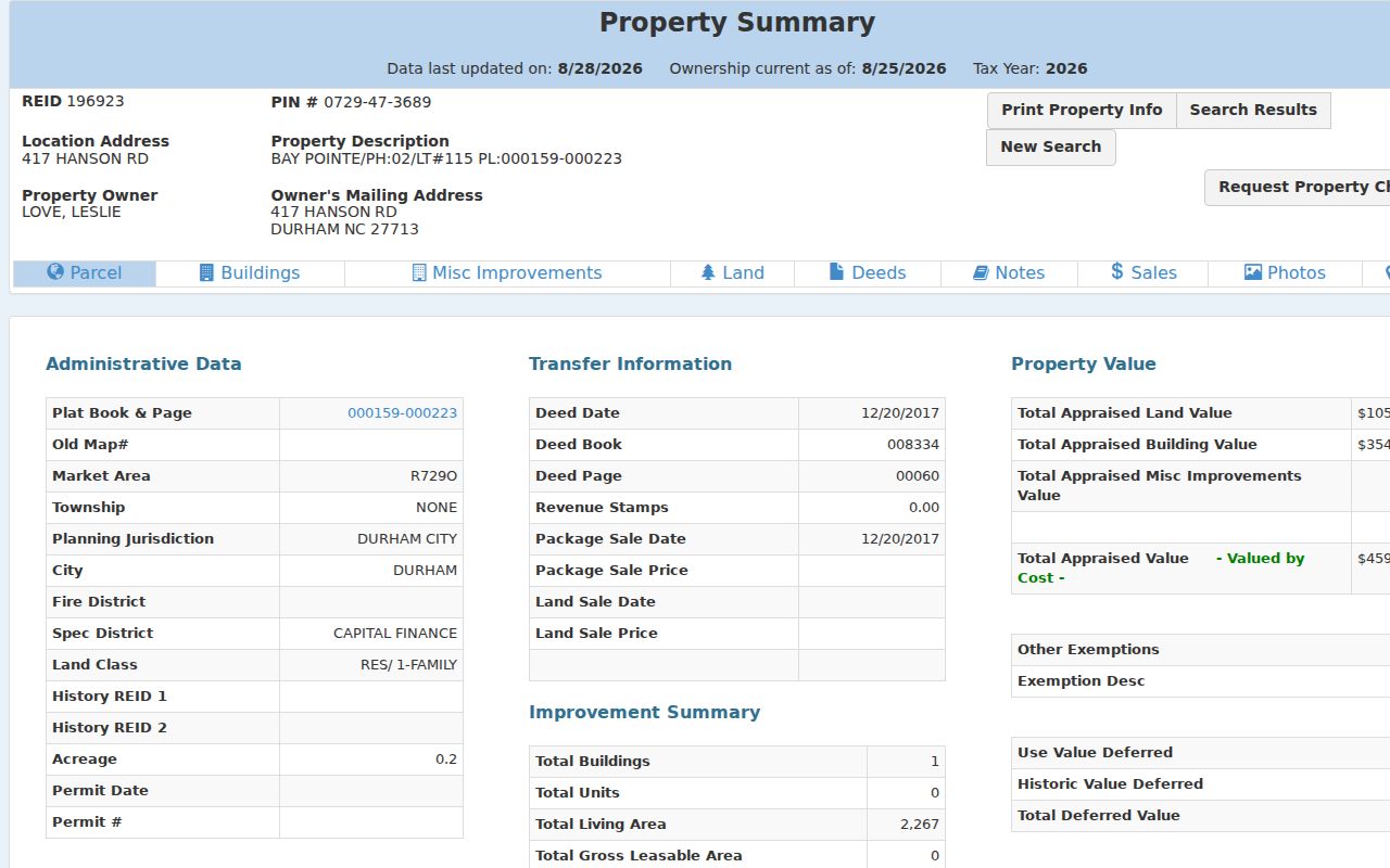
The screen’s update date answers a different question from a deed recording date, so both dates should be retained in a Durham street directory record trail.
Durham Maps for Street Parcels
Durham Maps provides parcel data, current and historic aerials, zoning, floodplain and streams, historic properties and landmarks, city/county boundaries, and development-case tools. It is useful after a tax search because it gives spatial context to the REID or PIN. The map does not replace a recorded legal description or resolve a title question. Return to the deed and plat for that evidence.
The Mailing List Tool can buffer selected parcels, select parcels, and generate an address list. That makes it useful for a notice-area or adjacent-parcel task. The output remains an address list, not a list of residents, and a chosen buffer distance does not define a Durham neighborhood. Small Area Plans and associations use their own boundaries.
The Durham Maps viewer shows the layer and parcel-search environment used to add spatial context to an address.
Use the map to compare a Durham street parcel with nearby geometry and public layers, then verify consequential facts with the office responsible for the underlying record.
Durham Boundary Layers by Address
Durham postal, municipal, and county geography do not always match. The official Administrative MapServer has separate City of Durham, Durham County Boundary, Durham City and County, Research Triangle Park, and ZIP Code layers. A Durham mailing city or ZIP is not proof that a parcel lies inside city limits or even inside Durham County. Use the parcel jurisdiction with the city and county layers before deciding which office could hold a permit, tax, or service record.
Durham’s Administrative MapServer documents the separate public boundary and ZIP layers.
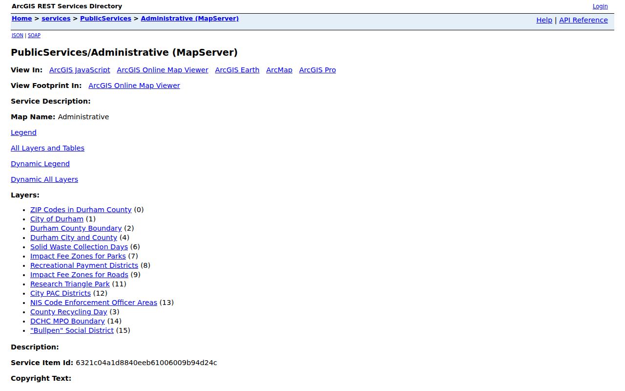
The layers supply geographic context for a Durham address, while the Tax Administration card and the underlying ordinance or deed remain the sources for their own claims.
Durham Street Permit History
The City-County LDO public Parcel Search covers most existing development applications, review comments, and inspection results for City and County parcels since October 2007. It accepts permit number, parcel ID, parcel PIN, street number, street name, unit number, first name, last name, and company name. An address search requires both street number and street name. Ordinary visitors use the public search, while staff create a CID or company-specific account on request.
A permit can reveal work at a Durham address, but it must be read as a permit record. The applicant, owner, or contractor may not be the resident. County permit guidance also says to check jurisdiction first. A pre-2007 construction lead should be routed to older paper records, archives, Building Safety, Planning, or another custodian instead of being treated as absent.
Durham’s LDO Parcel Search shows the address, parcel, PIN, and named-field route for public permit research.
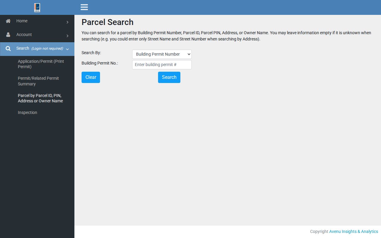
Preserving both the permit number and the Durham parcel identifier makes it easier to distinguish a work-history result from ownership or occupancy evidence.
Durham Deeds Along a Street
A deed chain starts at the parcel card’s deed reference, then moves through the Register of Deeds index. Record the instrument number, recording date and time, instrument type, grantor, grantee, book and page or image link, legal description, parcel or plat reference, and any prior-instrument reference. The consideration or revenue-stamp field, when shown, is a transaction indicator rather than a value conclusion. Follow a prior reference backward with care because an estate, trustee, merger, or organization can interrupt a simple name sequence.
Durham’s online real-estate system does not include Historical Record, Condo Books, Corporate Books, Mortgage Books, or Plat Books. Exact online coverage is not stated. For an excluded book, historic index, or certified copy, use the Register of Deeds in person at 201 E. Main Street, call 919-560-0480 for office questions, or use the documented certificate and copy route. Online images are useful, but they are not the only channel.
Durham Street Records and Sources
Address-keyed Durham records work as a chain, not as one street directory. A tax card points to a parcel. The deed supplies legal parties and description. GIS shows geometry and layered context. LDO supplies work-related activity. The library’s street section supplies historical listings. Each source has a separate keeper, access path, and limit, which prevents a strong fact in one system from becoming an unsupported claim in another.
| Durham address record | Keeper | What it can show | Access path |
|---|---|---|---|
| Tax parcel card | Tax Administration | REID/PIN, owner display, mailing and situs, deed/plat reference | Public portal, static files, or office contact |
| Recorded deed or deed of trust | Register of Deeds | Legal parties, recording date, book/page, legal description | Online for many series; historic and certified access onsite |
| Plat and parcel geometry | ROD and GIS | Lots, streets, easements, boundaries, and layers | Book/page and Durham Maps services |
| Permit or inspection | City-County LDO | Application, comment, inspection, and status | Public search since October 2007, after jurisdiction check |
| Historic directory street section | Durham County Library | Dated person, business, or address snapshot | Collection, scans, and Main Library access |
Online tax, GIS, ROD, LDO, ZIP-layer, and directory channels come first. The documented fallbacks are the ROD historical books, Tax mapping staff, Building Safety, Planning, the Main Library, phone or email to the relevant office, certified mail requests, library reproduction requests, and City or County public-record requests for an existing file. No portal proves continuous occupancy.
Durham Historic Street Evidence
For a past Durham street, library directories preserve a different kind of evidence from a modern parcel card. Durham County Library describes alphabetical surname and street-address sections. Annual print directories reach back to 1903, late nineteenth-century issues reach 1892, and DigitalNC supplies Durham material from approximately 1875 through 1963. Telephone directories span 1927 and 1950 through 2016. Greater Durham cross-reference directories combine phone and street-address information from 1962 to the present collection range.
Compare the directory year with a deed, map, newspaper, or archive record. A directory can omit a household, use an abbreviation, or list a business and address arrangement rather than a residence. The Durham city directory collection page is the appropriate route for the historical shelf and its dated editions.
Durham land-record GIS guidance explains why the parcel card, deed, and GIS acreage can answer different questions.
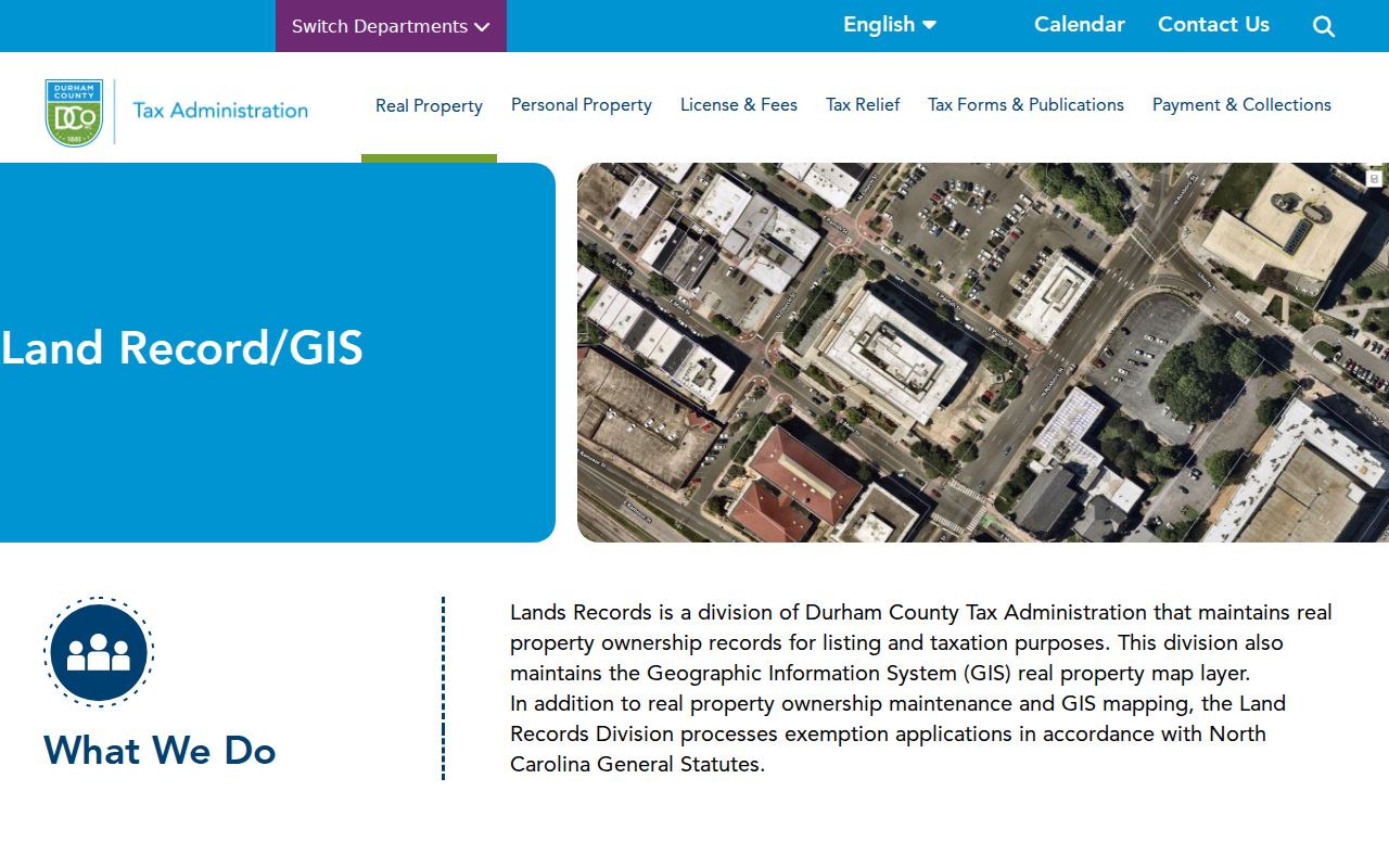
The best historic Durham street trail keeps the directory’s date separate from the map’s geometry and the deed’s legal description.
Durham Street Names and Boundaries
Street history can change the physical meaning of an address. Durham’s urban-renewal history altered parts of Hayti, rerouted streets, and changed blocks. The Walltown plan describes private alleys and lots that can make a rear-lot or alley address appear inconsistent with a modern map. Use a directory street section, a recorded plat, an aerial, and the relevant plan together when a present parcel seems out of step with an older record.
Boundary evidence has the same limit. ZIP layers show postal geography. City and county layers show jurisdiction context. An annexation or street-closing proceeding can supply the underlying civic history. They should be read with the date and document source, rather than used to turn a postal label into an ownership or residence claim.
Note: A changed street name or altered block is a reason to compare sources by date, not a reason to discard a historic record.
Durham Street Directory Limits
A street directory does not create a current household list. The tax portal identifies ownership data and parcel fields. A deed identifies recorded parties. A voter record is registration evidence with protected fields omitted. A permit can identify activity at an address. A library directory is a historical snapshot. The North Carolina Address Confidentiality Program can also make a real address absent or substituted as a safety measure for qualifying participants.
When a Durham search needs a correction, a certified copy, a protected-record answer, or a record absent online, contact the custodian rather than attempting to reconstruct restricted information from other sources.